Aerial Photography Products for Utah
All aerial photography downloads available from AGRC, with the exception of the Hexagon and Google imagery, have a UTM NAD83 zone 12 north meters projection.
If you have any problems or issues with the Hexagon or Google imagery products, take a look at the Imagery Format Problem Fixes and Workarounds. In addition to a list of common issues, we also provide descriptions and workarounds. If you are can't find the information you need there, please direct any questions or comments to Rick Kelson from AGRC at RKelson@utah.gov.
Most of the products below are also available as web services from our Discover basemap and imagery service. Please check the main Discover page for more information.
Hexagon Licensed Imagery
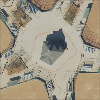
- Natural Color (RGB)
- ~1-foot or ~6-inch pixels
AGRC has a public-sector license to Hexagon's 30cm (~1-foot) and 15cm (~6-inch) aerial photography. The 30cm Hexagon imagery is a higher-resolution copy of the statewide 2018 NAIP imagery. The 15cm imagery was flown in November 2019 and covers Logan, St. George, and the Wasatch Front. The 30cm imagery has a horizontal positional accuracy of 2.6 meters (CE90) while the 15cm imagery has an accuracy of 1.07m (CE90).
This is a licensed product. To see whether you are eligible to use the Hexagon Imagery, head over to our Discover licensed imagery page to get the most accurate information.
Google Licensed Imagery
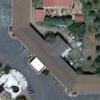
- Natural Color (RGB)
- ~6-inch pixels
AGRC has a public-sector license to Google's statewide 6-inch aerial photography. The Google license is for color aerial photography, typically collected during the spring, summer, or fall. The imagery is statewide, and the resolution is 6 inch or better with a horizontal positional accuracy to achieve or exceed 1 meter (CE90) in most areas without significant vertical relief.
This is a licensed product. To see whether you are eligible to use the Google Imagery, head over to our Discover licensed imagery page to get the most accurate information.
High Resolution Orthophotography | HRO
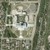
- Natural Color (RGB)
- False Color (CIR)
- ~1-foot or ~6-inch pixels
High Resolution Orthophotography (HRO) is color aerial photography collected in the spring or fall for select areas in Utah. The resolution is 1 foot or better with a horizontal positional accuracy of +- 75cm for 2006 and 2009 and +- 37.5cm for 2012 imagery. The 2003 Urban Area Orthoimagery (UAO) is considered part of the HRO collection. Currently there is HRO imagery from 2003, 2006, 2009, and 2012.
Download Links
National Agriculture Imagery Program | NAIP
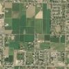
- Natural Color (RGB)
- False Color (CIR)
- ~1-meter pixels
The National Agriculture Imagery Program (NAIP) typically collects color aerial photography every 2 or 3 years in the middle of the summer. Starting in 2006 the acquisitions have been statewide. The resolution is usually 1 meter with a horizontal positional accuracy of 5 meters. In addition to the 3-band RGB color imagery, there is a color-infrared dataset from 2006 and a 3-band and 4-band dataset from 2009. The 2011 dataset is 4-band for the TIFF images and 3-band for the county mosaics. The 2014, 2016, & 2018 datasets are 3-band with separate single-band image tiles for the 4th band for the TIFF images, and the county mosaics are 3-band. Currently there is NAIP imagery from 2003, 2004, 2006, 2009, 2011, 2014, 2016, and 2018.
Download Links
Digital Orthophoto Quads | DOQ
- Black and White
- ~1-meter pixels
Digital Orthophoto Quads (DOQ) are typically black-and-white aerial photos with a 1-meter resolution. In some cases the DOQs are 0.5 meter, color, or 4-band. The boundaries of the imagery tiles correspond to the boundaries of 1:24,000 US Geological Society (USGS) topographic maps. The 1990s collection is statewide.
Download Links
1935-Present Utah Geological Survey Scanned Aerial Imagery Collection
The Utah Geological Survey (UGS) scanned aerial imagery collection can be downloaded via the UGS interactive map.