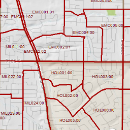
Voting Precincts
- Category: Political
- Data Type: GIS Data Layer
- Steward(s): AGRC
- Abstract: Voting precincts determine a voter's ballot composition and polling location. Voting precinct boundaries take their shape from the boundaries of all political districts, including U.S Congress, State Senate, State House, School Board District, local council districts, special districts etc. However voter precincts must be drawn so that they contain less than maximum number of voters as specified by state law. Voting precincts are a critical part of the VISTA application, which is the statewide framework, overseen by the Lt. Governor's Office, for managing voters and elections.
Voting Precincts

Political.VistaBallotAreas are voting precincts for all 29 counties in Utah. Precincts boundaries are submitted by County Clerk offices. Where precincts are split into formal subprecincts, only the subprecincts are included in this dataset. A 'Dissolve' operation on the PRECINCTID field will produce precinct polygons without subprecinct lines.
- VISTAID
- A 11 character field that contains the precinct ID and optional subprecinct ID (separated by a colon).
- PRECINCTID
- The precinct component of VISTAID.
- SUBPRECINCTID
- The subprecinct component, where applicable, of VISTAID.
- VERSIONNBR
- An optional version reference name assigned by the county.
- EFFECTIVEDATE
- The date the precinct boundary took effect. A date of 1/1/2011 is the default effective date.
- RECEIVEDDATE
- Indicate the date the precinct boundary was sent from the county to the AGRC.
Comments, questions, compliments, or concerns can be directed to Justin Lee from Lieutenant Governor's Office at JustinLee@utah.gov.
Related Resources
Downloads and Web Services
Updates
- October 11,2019
- July 3,2019
Check attributeRECEIVEDDATEto identify latest updates to specific precinct features.