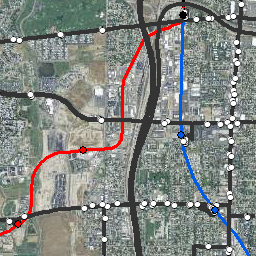
Transit

Bus, Commuter, and Light Rail
- Category: Transportation
- Data Type: GIS Data Layer
- Steward(s): Utah Transit Authority (UTA)
- Abstract: This dataset contains the UTA bus route and stop locations, commuter rail route and stop locations, and light rail route and stop locations. The extent of these data is primarily along the Wasatch Front.
UTA Bus Routes & Stops

Transportation.BusRoutes_UTA includes bus stops along streets, at TRAX stations, and park & ride lots serviced by UTA buses. Transportation.BusStops_UTA includes redesigned bus routes that have been adjusted for internal monitoring purposes and ski bus routes to the Cottonwood Canyons and Sundance Ski Resort.
The UTA Bus Stops dataset was digitized to the Wasatch Front counties' street base maps and then exported from Trapeze (scheduling software) in shapefile format.
Comments, questions, compliments, or concerns can be directed to Sumer Ellis from UTA at SEllis@rideuta.com.
Downloads and Web Services
Updates
- April, 2020
UTA Commuter Rail Routes

Transportation.CommuterRailRoutes_UTA depicts the route of Utah Transit Authority's FrontRunner North and South commuter rail tracks as received from UTA May of 2013.
Comments, questions, compliments, or concerns can be directed to Sumer Ellis from UTA at SEllis@rideuta.com.
Downloads and Web Services
Updates
- May, 2013
UTA Commuter Rail Stations

Transportation.CommuterRailStations_UTA depicts the locations of Utah Transit Authority's FrontRunner North and South commuter rail stations as received from UTA.
These data include an attribute of the address where the rail station is located.
Comments, questions, compliments, or concerns can be directed to Sumer Ellis from UTA at SEllis@rideuta.com.
Downloads and Web Services
Updates
- May, 2013
UTA Light Rail

Transportation.LightRail_UTA represents the light rail system for the main North-South (Downtown to Sandy), University/Medical Center, West Valley, Daybreak, and Airport lines. It also depicts the Sugar House trolley extension currently under construction.
LightRail_UTA was digitized from aerial photographs dated August, 2016.
The native spatial reference for this dataset is UTM Zone 12N, NAD83 (0.01 coordinate precision).
Comments, questions, compliments, or concerns can be directed to Sumer Ellis from UTA at SEllis@rideuta.com.
Downloads and Web Services
Updates
- January, 2017
UTA Light Rail Stations

Transportation.LightRailStations_UTA represents the center of the platform at all UTA light rail stations.
LightRailStations_UTA locations were digitized from aerial photographs dated 2012. The 900 South station and Sandy Expo station locations were obtained by GPS.
The native spatial reference for this dataset is UTM Zone 12N, NAD83 (0.01 coordinate precision).
Comments, questions, compliments, or concerns can be directed to Sumer Ellis from UTA at SEllis@rideuta.com.
Downloads and Web Services
Updates
- May 12, 2013