By JP on Dec 06, 2013
Mapping Spotlight: Division of Water Resources Interactive Maps
This article will take 1 minute to read
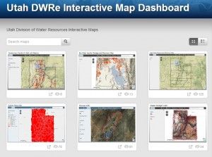
 The Division of Water Resources (DWRe) at the Department of Natural Resources has created an interactive map gallery using ArcGIS Online to showcase all of DWRe's interactive maps in a single location. The interactive map gallery provides easy navigation and a static location for finding newly created maps.
The maps in the gallery range from a basic water resources reference map to a map of the Fremont River and it's local reservoirs and diversions. The maps can be used to reference anything related to water resources, such as water-related land use, tracking DWRe's projects, and drought conditions/water supply.
For a complete list of all the maps and their descriptions, click here. To view the gallery, click here.
‘Mapping Spotlight’, a new feature for gis.utah.gov, spotlights some of the many interesting and useful maps being created by state and local government in Utah. If you have a map you'd like considered for the spotlight, contact the staff from AGRC at agrc@utah.gov or 801-538-3665.