By Rick Kelson on Jan 17, 2019
NAIP 2018 Mr. Sid County Mosaics Available
This article will take 2 minutes to read
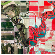
The statewide 2018 National Agricultural Imagery Program (NAIP) aerial photography is now available. This year the imagery is higher resolution .6 meter (60 centimeter) imagery compared to 1 meter resolution in previous years. The imagery is currently only available as 3-band Natural Color (RGB) and 3-band Color Infrared (CIR) Mr. Sid compressed county mosaics. The 4-band GeoTIFF or JP2 tiles should be available in a couple of months with statewide imagery services soon to follow.
The files can be downloaded from Raster.utah.gov or from the following links. The dates the imagery was collected can be found in the shapefile associate with each download.
- Beaver Natural Color (RGB) Color Infrared (CIR)
- BoxElder Natural Color (RGB) Color Infrared (CIR)
- Cache Natural Color (RGB) Color Infrared (CIR)
- Carbon Natural Color (RGB) Color Infrared (CIR)
- Daggett Natural Color (RGB) Color Infrared (CIR)
- Davis Natural Color (RGB) Color Infrared (CIR)
- Duchesne Natural Color (RGB) Color Infrared (CIR)
- Emery Natural Color (RGB) Color Infrared (CIR)
- Garfield Natural Color (RGB) Color Infrared (CIR)
- Grand Natural Color (RGB) Color Infrared (CIR)
- Iron Natural Color (RGB) Color Infrared (CIR)
- Juab Natural Color (RGB) Color Infrared (CIR)
- Kane Natural Color (RGB) Color Infrared (CIR)
- Millard Natural Color (RGB) Color Infrared (CIR)
- Morgan Natural Color (RGB) Color Infrared (CIR)
- Piute Natural Color (RGB) Color Infrared (CIR)
- Rich Natural Color (RGB) Color Infrared (CIR)
- Salt Lake Natural Color (RGB) Color Infrared (CIR)
- San Juan Natural Color (RGB) Color Infrared (CIR)
- Sanpete Natural Color (RGB) Color Infrared (CIR)
- Sevier Natural Color (RGB) Color Infrared (CIR)
- Summit Natural Color (RGB) Color Infrared (CIR)
- Tooele Natural Color (RGB) Color Infrared (CIR)
- Uintah Natural Color (RGB) Color Infrared (CIR)
- Utah Natural Color (RGB) Color Infrared (CIR)
- Wasatch Natural Color (RGB) Color Infrared (CIR)
- Washington Natural Color (RGB) Color Infrared (CIR)
- Wayne Natural Color (RGB) Color Infrared (CIR)
- Weber Natural Color (RGB) Color Infrared (CIR)
