By Zach Beck on Aug 01, 2012
Using Utah GIS Elevation Data to Visualize Terrain
This article will take 1 minute to read

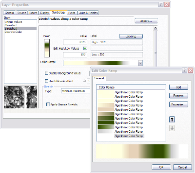
To highlight elevation in the Utah Terrain Base Map, a custom color ramp symbol was created to enhance the basic gray-scale hillshading. By editing the color ramp properties of the DEM, a user can define colors stretched between the maximum and minimum elevation values to represent biomes across the state. In the case of the Utah Terrain Base Map, 11 algorithmic 1-2 value color ramps were stretched between a minimum value of 500 meters and a maximum of 3375 meters. Overlaying this symbology upon a hillshade will represent lower elevations in shades of tan, increasing to green in more mountainous regions, and ending with white representing a snow line at about 9,500 feet.
Tips & Tricks To highlight terrain features beyond what can be shown with a hillshade, consider adding slope data as well. A slope raster is derived from a DEM and can represent slope as a percentage or degree. When symbolized with a grey scale, flat areas will appear white highlighting the darker, steeper areas. When used with a hillshade terrain features become more pronounced. Ideally the hillshade and slope data should be blended together, however, adjusting the transparency of one or both of the layers achieves a similar effect.