By Bert Granberg on Jun 25, 2019
Where Will Population and Jobs Grow along the Wasatch Front?
This article will take 1 minute to read
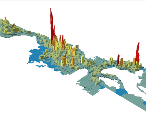
Seven new GIS datasets are now available that provide annual projections, through 2050, of population and job densities for the Salt Lake - Provo - Ogden urban corridor extending from Santaquin north to Brigham City. The projections datasets each present the annual forecasted counts for each year 2019 through 2050 for the following variables:
- Population (excluding group quarters)
- Household Count (excluding group quarters)
- Total Jobs
- Industrial Jobs
- Office Jobs
- Retail Jobs
- Typical Jobs (a subtotal of jobs with typical travel & commuting patterns (sums Industrial, Office, & Retail Jobs)
- Nontypical Jobs (with non typical travel demand, sums agriculture, constructions, & mining jobs)
Actually there are 14 datasets, as this data is available at two geographic levels:
- “City Areas” aggregations that closely reflect current city boundaries, and
- Traffic Analysis Zone polygons, which are much smaller.
The projections datasets were created using the Real Estate Market Model (REMM), an UrbanSim-based model developed by WFRC and MAG to support transportation and land use planning. To arrive at its predictions for our future, REMM relies upon a developer profitability module and input data, including: detailed county tax parcel GIS layers, transportation plans, envisioned land uses, and county-level projections from the U of U’s Gardner Policy Institute (control totals).
If you’re looking to learn more about these datasets, this metadata doc is your friend.
