By Bert Granberg on May 26, 2016
Work Group Recommends Expanded GIS Parcel Sharing
This article will take 2 minutes to read
A Proposal for Voluntary Expanding Parcel Data Sharing
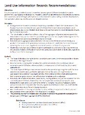
Earlier this month, the Land Information Records work group, an informal committee organized by Evan Curtis, the State Planning Coordinator with the Governor’s Office of Management and Budget, produced recommendations for expanding the sharing of GIS-based parcel information.

Participants in the LIR work group include representatives from county, regional, and state government, including the Utah Association of Counties (County Assessors and County Recorders), Wasatch Front Regional Council, Mountainland and Bear River AOGs, Utah League of Cities and Towns, UDOT, DNR, AGRC, the Division of Emergency Management, Blue Stakes, economic developers, and academic researchers.
The LIR work group’s recommendations set the stage for voluntary sharing of additional objective/quantitative parcel GIS data, primarily around tax assessment-related information. Specifically the recommendations document establishes objectives, principles (including the role of local and state government), data content items, expected users, and a general process for data aggregation and publishing.
An important realization made by the group was that ‘parcel data’ or ‘parcel record’ products have a different meaning to different users and data stewards (see more detailed explanation). The LIR group focused, specifically, on defining a data sharing recommendation around a tax year parcel GIS data product, aligned with the finalization of the property tax roll by County Assessors on May 22nd of each year.
The LIR recommendations do not impact the periodic sharing of basic parcel GIS data (boundary, ID, address) from the County Recorders to AGRC per 63F-1-506 (3.b.vi). Both the tax year parcel and the basic parcel GIS layers are designed for general purpose uses, and are not substitutes for researching and obtaining the most current, legal land records information on file in County records.
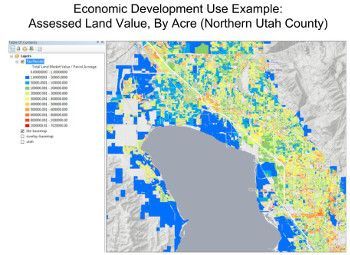
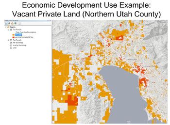
It is hoped that this new expanded parcel GIS layer will be put to immediate use supporting the best possible outcomes in public safety, economic development, transportation, planning, and the provision of public services. Two quick map examples, at the bottom of this post, illustrate how land value and vacant land can be visualized from the expanded parcel information.
Another aim of the work group was to improve the usability of the data (through development of standards and consistent metadata documentation) and the efficiency with which the data sharing is distributed.
Next Steps
-
AGRC will interface with counties and the GIS community to propose and finalize the GIS data schema based on the group’s recommendations to date. It is hoped this process can be completed by mid-June.
-
Once the proposed data schema is completed, it will be distributed to the county assessors for a final review, followed by an invitation to submit the most recent tax parcel data for the 2016 calendar year. The initial focus will be publishing a GIS layer for the Wasatch Front, Wasatch Back, and other high-growth counties.
-
AGRC will work with counties to collect, aggregate and publish the tax parcels according to the agreed upon schema.

